|
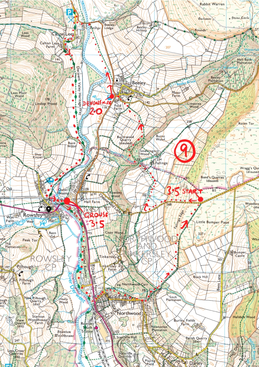
70. Rowsley 9th August 2014. Parking on chesterfield lane on the grass verge next to the path sign near Falling edge. Heading west down the road taking the path on the right just before the farm track which eventally joins the farm track, the farmer pulled up and we told him we were looking for the public footpath across his fields but he said it’s always been this way and we should take the farm track instead,not very convincing as we could see the way marked clearly on the OS map. North through the farm and on through Smelting Mill Wood to Chesterfield Road, Beeley and the Devonshire arms for some refreshments. Up Chapel Hill then left to Church Lane and taking the path opposite on the B6012. Taking the unmistakable Chatsworth land then crossing the river Derwent on the left then heading south down by the side of the river then turn left on Church Lane and right onto the A6 round the corner to the Grouse and Claret. Up towards the traffic lights taking station close on the right, to the end following the Derwent Valley Heritage Way south to the end of the old railway line then left onto the road crossing at the the pedestrian crossing then to the left is a narrow path heading up through the houses and up the very steep Northwood Road ( should be Skywood Road !) bending round to the right at the top then taking a left up Lumbs Lane heading north east across fields and back to the car. |
|---|